
Lorton ZIP Code Coverage
The postal geography that serves Lorton is best read as a delivery system, not a municipal map. Lorton is an unincorporated Fairfax County community, so county and state offices handle address, parcel, and records questions. USPS and Fairfax sources identify 22079 as the core Lorton postal community and also associate 22199 with Lorton VA 22079. Check an individual delivery address in the postal tool before treating either label as the final formatting answer.
| ZIP | Areas Covered | Post Office | Notes |
|---|---|---|---|
| 22079 | Lorton postal community, including Lorton, Laurel Hill, Mason Neck, and surrounding Fairfax delivery addresses in the official county and USPS context | Lorton Post Office, 7726 Gunston Plaza, Lorton VA 22079-9998; 703-339-6374; Monday-Friday 9-5, Saturday 9-1 | Postal and county ZIP sources, not a city-limit polygon |
| 22199 | Official USPS label-list mapping associates it with Lorton VA 22079 | Associated ZIP in the USPS label-list data | The inspected source does not state an exact PO-box classification; verify each address with USPS |
The Lorton Post Office lists PO Box delivery through 11 on weekdays and Saturday. Postal office hours and a delivery ZIP answer different questions, so use the location page for counter service and the address tool for a specific address.
Verify Lorton ZIP Codes
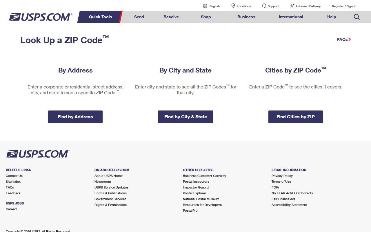
USPS ZIP Code Lookup offers By Address, By City and State, and Cities by ZIP tabs. The By Address form asks for a required street address, city, and state, with optional company, apartment or suite, and ZIP fields. A Find control returns the postal result. Some displays also expose an Urbanization Code when it applies.
| USPS mode or field | How it helps a Lorton ZIP code check |
|---|---|
| By Address | Tests the full street address against postal formatting |
| By City and State | Finds ZIP possibilities from a recognized city and state pair |
| Cities by ZIP | Shows postal city associations for a ZIP |
| Apt/Suite/Other | Optional address qualifier where an individual delivery needs it |
| ZIP field | Optional entry to refine an address check, not identity confirmation |
The USPS ZIP lookup screen shows its three verification modes.
USPS warns that a ZIP result does not confirm a person or company at an address. It is a delivery-format result, not a resident record.
Search a Lorton ZIP Code
A ZIP filter can narrow address and permit research, but it cannot create a roster of people. Use the source that matches the question. USPS supplies postal formatting. MAR works with address status and history. PLUS searches public county record types. Jade maps ZIP geography and parcels. iCare then opens assessment information one parcel at a time rather than as a ZIP-wide owner search.
- Verify the full street address with USPS and record the returned city, state, ZIP, and ZIP+4 when supplied.
- Search Fairfax MAR by ZIP with the address, parcel, subdivision, and current or historical status filters needed for the question.
- Use Fairfax PLUS to search public permit or application records by ZIP, address, parcel, date, project, unit, or record type.
- Open Jade's ZIP boundary and parcel layers to check the geographic relationship.
- Use iCare parcel by parcel for assessment information, while keeping owner, mailing, and situs fields separate.
Save the ZIP entered, USPS return, MAR status date, PIN, county planning label, subdivision, and portal used. If USPS and MAR differ, check both systems again or ask Fairfax GIS/addressing rather than changing a value from memory. Note: A ZIP narrows a search area, but it does not establish who lives in that area.
Lorton MAR ZIP History
Fairfax MAR is the county's authoritative site-address search for Lorton. Its filters include address number, street name and type, city, ZIP, parcel ID, subdivision, and created or expired date ranges. Address, parcel, and street searches can return current, historical, or all status results. Current is the default, so an older address question requires an intentional status change.
MAR is valuable when a street name, PIN, or address status needs checking. It can bridge a historical address to a current parcel before a deed or assessment review. It does not contain Department of Tax Administration owner data, and it excludes several separate jurisdictions such as the City of Fairfax, Falls Church, Arlington, and Alexandria. Lorton remains within the Fairfax County coverage area.
Lorton ZIP Code Research Log
Record the exact field and source behind every Lorton ZIP code result. Start with the ZIP entered and the city and state returned by USPS. Add a ZIP+4 only when the postal tool supplies one for that address. In MAR, preserve the parcel or PIN, subdivision, created or expired date, and whether current, historical, or all status was used. These details explain why two searches can produce different results without treating either one as an error.
County planning labels add another layer. A result may use a Lorton, Laurel Hill, Mason Neck, Lorton Station, or Lorton Valley label while the postal result expects Lorton. Save that planning or subdivision label separately from the ZIP. iCare's displayed address form has no ZIP field, so it is not the appropriate ZIP-wide filter. Its parcel profile is the later, parcel-by-parcel check after USPS, MAR, PLUS, and Jade have narrowed the geographic question.
Lorton PLUS ZIP Records
Fairfax PLUS is the ZIP-capable county record route for public permit, enforcement, planning, zoning, site, environmental-health, and fire material. Its general search exposes City, State, ZIP Code, and Parcel ID together with record type, project, date, unit, country, and additional criteria. These filters can locate public record entries that are tied to a place, but their presence does not identify every resident there.
| PLUS field | ZIP code directory use |
|---|---|
| City, State, ZIP Code | Narrows the county record search by postal-style address data |
| Parcel ID | Connects a record to a known county parcel |
| Record type and project | Separates permit or application categories |
| Date and unit | Refines a record period or multi-unit address |
For older material, Fairfax directs users to the legacy LDIH route where applicable. PLUS supports public browsing, while an account is needed for transactions. Note: Use the official county page for payments because PLUS warns about fraudulent wire-transfer requests.
Map Lorton ZIP Geography
Jade offers address and parcel searching, map layers, property reports, imagery, and export tools. Its AdminBoundaries group includes ZIP geographies, which can show how a postal area relates to parcels and other county layers. The map can support a geographic check after USPS and MAR return an address, but it is not a survey and its layer behavior can vary.
Use Jade to see a parcel's mapped setting, then return to MAR for address status and iCare for assessment data. A ZIP layer does not create a unified Lorton residential list, and the map's nearby or export tools should not be treated as proof of household membership. Parcel geometry, delivery labels, and ownership are three separate kinds of information.
Lorton ZIP Code Labels
Lorton postal labels sit within southern Fairfax County's Lower Potomac planning context. Laurel Hill, Mason Neck, Lorton Station, Lorton Valley, South County, and Lorton-South Route 1 can appear as neighborhood, planning, association, map, permit, or historical terms. A parcel may carry one of those local identifiers while USPS expects Lorton and 22079 for mail. That is normal postal and county geography, not a contradiction.
A Fairfax market study uses 22079 as a Lorton Census Tract Area for its study data. That planning or statistical use does not mean every 22079 delivery address sits inside one census-designated-place boundary. Keep the source's geography and date with any demographic figure, rather than carrying a postal label into a different boundary system.
The official USPS label list associates both 22079 and 22199 with Lorton VA 22079, but the inspected sources did not provide a dated narrative for a ZIP split or realignment. Treat the August 1, 2025 label list as a dated current mapping source, not an origin story. No directly comparable current population or voter count for the Lorton postal community was verified, so this Lorton ZIP code directory does not supply one.
Lorton ZIP Code Definitions
Postal terms can look more precise than they are. Use them carefully when recording a Lorton address or checking a county search result.
- ZIP Code
- A USPS delivery geography used to sort and format mail. It is not a municipal boundary.
- ZIP+4
- An added four-digit delivery detail that may be returned for a specific address or delivery point.
- PO Box code or associated delivery code
- A postal designation that can be associated with a place label without describing a physical neighborhood. The inspected 22199 source does not state its exact category.
- Carrier route
- A postal delivery grouping used for mail operations. It does not identify a household roster or prove occupancy.
These terms explain mail processing. They do not replace the county's legal parcel description, situs, or address-history record.
Lorton ZIP Code Limits
The common myth is that a Lorton ZIP establishes a city boundary or proves a person lives at an address. Neither is true. Lorton has no municipal records office because it is unincorporated. USPS verifies delivery information, MAR verifies county address data, Jade maps geography, and iCare may identify an owner of record. Each result has a limited purpose and none is a complete residential roster.
Use a ZIP carefully. A postal result may support address formatting, but it must not be used to infer a person's presence or bypass protected information.
When a ZIP has narrowed the address question to one street, use the By Street directory for the county's address-keyed records. For a person-specific question, use records that support an identity match and respect their access limits. Note: Postal geography is useful evidence of delivery context, not evidence of residence.